RiversInformation Wellandfor andboaters Glen:- locksrivers Welland and facilities
Glen
Information forabout boaters on the Riversrivers Welland and Glen.Glen including navigation, events, speed exemptions, bridge heights, locks and slipways.
River conditions
You can find current river conditions on Anglian Waterways: river conditions, closures and restrictions.
You can also:
- find out more about river advice for boaters
- register for the service
About the rivers
The River Glen is 18.5 kilometres long with a towpath for its entire length. It rises in the Lincolnshire Limestone Ridge, east of Grantham. It travels for 12 miles through the Fens where it meets the River Welland at Surfleet Seas End. It is navigable from Surfleet Seas End to Tongue End. After the sluice gates at Surfleet Reservoir the Glen becomes tidal before joining the Welland which flows into the Wash.
The River Welland is 105 kilometres. It flows eastwards through Crowland and Spalding and into the Wash at Fosdyke Bridge, crossing the area of Lincolnshire fenland known as ‘South Holland’. The upper reaches extend up in to Stamford, where the channel is small and only suitable for light craft and canoes.
TheDownstream Riverto GlenPeakirk, risesthe channel widens and larger craft can navigate with care. From Peakirk downstream, the channel is suitable for small sail craft using the water close to Spalding.
Downstream of Spalding, the Welland becomes tidal in nature and is met by the LincolnshireRiver LimestoneGlen Ridge,at eastSurfleet, before merging into the Wash Area of Grantham.Outstanding ItNatural travelsBeauty for(AONB).
The 12slipway milesat throughCrowland offers registered craft safe and easy access into the FensWelland.
Navigation wherenotices
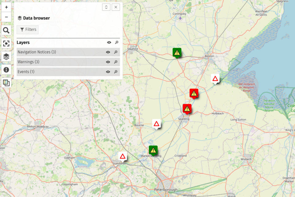
You itcan meetssee the latest navigation notices on our mapping tool.
Useful information
Organising an event
If you want to organise an event on the River Welland, read the . You can apply for an event using the Anglian Waterways event form.
Speed limit
There is a general speed limit of 7 miles per hour (11.2 kilometres per hour) on the Rivers Welland and Glen.
Request a speed exemption
VisitTo request a speed exemption, read the Inland. mapYou andcan aboutapply for a speed exemption using the Anglian Waterways Linkspeed projectexemption form.
River Inspector
ReadYou can contact the recreationalriver byelawsinspector foron Anglian07825 waterways.503848.
Rivers Welland and Glen bridge heights
Water levels on the Welland and Glen may change after rainfall. When you approach a bridge you must make sure there is enough space between your boat and the roof of the bridge to allow your boat to pass safely.
The following table shows the distance between the standard water level and the highest point of the bridge. These distances are approximate and river levels fluctuate throughout the year.
| Location | Headway (metres) | Headway (feet) |
|---|---|---|
| Deepings Railway Bridge | 3.24 | 10’63” |
| Crowland Bridge | 2.27 | 7’45” |
| Four Mile Bar Footbridge | 3.20 | 10’49” |
| A16 Road Bridge | 2.93 | 9’61” |
| Bars Bridge | 2.62 | 8’59” |
| Boadring Footbridge | 2.45 | 8’04” |
| Money Bridge | 2.0 | 6’56” |
| Railway Bridge | 2.23 | 7’32” |
| Herring Bridge | 2.21 | 7’25” |
| Crossgate Bridge (Flat Mill) | 2.0 | 6’56” |
| Surfleet Iron Bridge | 1.8 | 5’90” |
| A16 Bypass Road Bridge | 2.75 | 9’02” |
| Little London Bridge | 2.01 | 6’59” |
| Old Railway Bridge and Footbridge | 2.42 | 7’93” |
| Balmoral Avenue Footbridge | 1.85 | 6’07” |
| Love Lane Footbridge | 2.54 | 8’33” |
| Pipe Line | 3.31 | 10’86” |
| No. 3 Taku Footbridge | 2.96 | 9’71” |
| High Bridge | 2.38 | 7’80” |
| No. 2 Footbridge | 2.74 | 8’99” |
| West Elloe Footbridge | 2.24 | 7’35” |
| Twin Bridges | 2.33 | 7’64” |
Rivers Welland and Glen locks
There are 2 locks on the Rivers Welland and Glen. They are both staffed by the Environment Agency:
- Fulney Lock in Spalding, which marks the boundary between the non-tidal (or freshwater) River Welland with the tidal Welland
- Surfleet Sluice, which connects the River Glen to the River Welland
The river is tidal beyond Surfleet Seas End - only experienced sailors and boaters should go through this sluice and into the Wash.
You must not operate these locks yourself.
Lock keeping hours at Surfleet Sluice (River Glen)
CallSurfleet theSluice riverrequires inspectorat beforeleast you48 arrivehours’ throughnotice to arrange staffing from the Environment AgencyAgency. CustomerBookings Contactare Centredependent on 0370tidal 850conditions 6506and (can only be accommodated during suitable daylight locking windows.
To request a booking, call charges).03708 506 506.
Lock keeping hours at Fulney Lock (River Welland)
Fulney Lock requires at least 48 hours’ notice to arrange staffing from the Environment Agency. Bookings are dependent on tidal conditions and can only be accommodated during suitable daylight locking windows.
To request a booking, 07825 503 848.
Lock dimensions
Typically the locks on the Rivers Welland and Glen are 26m long and 4.6m wide.
Distances between locks
Distances and times between each lock based on the speed limit of 7 miles per hour and assumes that you will take 20 minutes to pass through each lock.
| Name | Distance to next lock downstream (km) | Distance to next lock downstream (miles) | Cruising time to next lock downstream |
|---|---|---|---|
| River Welland, Stamford to Peakirk (access to canoes and light boats only) | 19.31 | 12 | 2 days in a canoe |
| River Welland, Peakirk to Spalding | 23 | 14.29 | 7 hours |
| River Glen, Tongue End to Surfleet Seas End | 19 | 11.80 | 5 hours |
Public slipways
There are 3 public slipways on the Rivers Welland and Glen, located at:
- Crowland
- Fosdyke (this slipway is tidal)
- Surfleet
You need a navigation key to lift the traffic control barriers that protect these sites. You can buy a navigation key by emailing the Environment Agency at boatreg@environment-agency.gov.uk or calling 03708 506 506 (call charges).
For more information contact the Welland and Glen river inspector through the Environment Agency Customer Contact Centre on 0370 850 6506.
Mooring
Read the Anglian waterways guide for information on mooring.