RiverInformation Stour:for locksboaters and- facilities
River Stour
Information forabout boaters on the River Stour.Stour including navigation notices, event organisation, speed exemptions, locks, slipways and canoe access.
River conditions
You can find current river conditions on Anglian Waterways: river conditions, closures and restrictions.
You can also:
- find out more about river advice for boaters
- register for the service
About the river
The River Stour isforms athe naturalboundary riverbetween the counties of Suffolk and Essex, before flowing in the Stour estuary near Maninningtree. A public right of navigation exists between Brundon Mill just north of Sudbury and Cattawade, near Manningtree. Most of the historic lock structures have disappeared and it now has greater physical and ecological diversity, with fewgenerally locks.shallower water for shallow draft non-motorised craft.
You can use a powered boat on the 4km stretch from Ballingdon bridge to Henny Street Weir only. The rest of the river is quite shallow. You can still navigate it but you will need a boat with a shallow draft such as a canoe or rowing boat. There is a speed limit of 4mph on the whole river.
VisitRiver theInspectors Inlandfor WaterwaysEly AssociationOuse websiteand toStour: 07741 614 288
Navigation notices
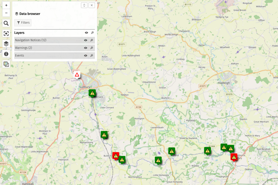
You can see the Fenslatest Waterwaysnavigation notices on the River Stour Mapping tool.
Useful information
Organising an event
If you want to organise an event on the River Stour, read the . You can apply for an event using the Anglian Waterways Linkevent projectform.
Request a speed exemption
ReadTo request a speed exemption, read the
. You can apply for a speed exemption using the Anglian waterwaysWaterway speed exemption form.
River Stour locks
There are 34 locks on the River Stour:
- Great Cornard
Locklock - Dedham Mill
Locklock - Flatford Mill
Lock
The lock at
Navigating the locks
You must not operate the locks on the River Stour yourself.
PleaseIf give the Environment Agency advance notice if you want to pass through any of the locks.locks Youyou canshould contact the river inspector through the Environment Agency Customer Contact Centre on 0370 850 6506 (find out about call charges).
The River Stour Trust may also be able to operate the locks on request..
Public slipways and canoe access
Public slipways and ramps are available for use on the River Stour at:
- Cattawade Barrage in Cattawade, a ramp for small boats only
- River Stour Trust Building in Sudbury, a slipway is open for registered boats
Other canoe launch and landing sites are available. Contact British Canoeing for more information on access and launch sites.
Canoe portage platforms
Portage platforms on the River Stour are maintained by the Environment Agency and are free for everyoneregistered boaters to use.
You can find them at:
- Great Cornard Mill
- Henny Weir
- Shalford Weir
- Pitmire Weir
- Dawes Weir
- Lamarsh Weir/Mill
- Bures Mill/Weir
- Wormingford Mill/Weir – please respect the privacy of the owner and keep to the marked route when using this portage and do not loiter
- Wiston Mill – caution, there’s a steep bank and camber towards the river on this portage route, make sure your canoe descends the downstream portage slope either bow or stern first
- Nayland Weir
- Boxted Mill/Weir – portage is via a private garden, please respect the owner’s privacy and keep strictly to the signed portage route
- Langham Flumes – caution, Langham Flumes gauging station has steep fenced banks and fast flowing water, use portage
- Stratford St Mary
- Dedham Mill/Weir – informal shallow beach portage.
- Flatford Mill/Weir
- Brantham, Cattawade Bridge – this is a canoe access platform, there is a slip facility for larger boats to access the tidal river
Byelaws on unpowered craft
Unpowered craft (those that are peddled, paddled, rowed or sailed) can travel the whole length of the Stour navigation from Brundon Mill to Cattawade. Unless they have an exemption, powered craft are restricted to the length between Ballingdon Bridge and Henny Street.
Mooring
Read the Anglian waterways guide for information on mooring.